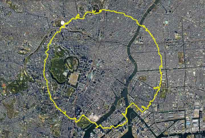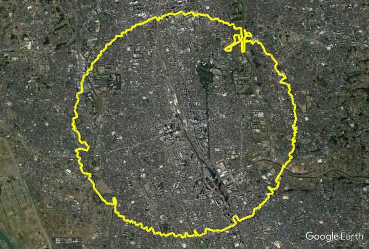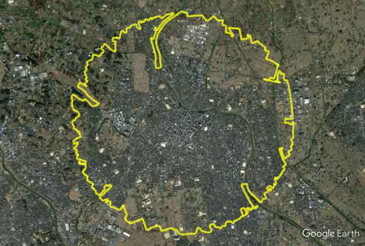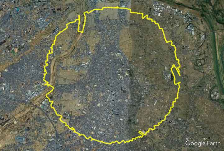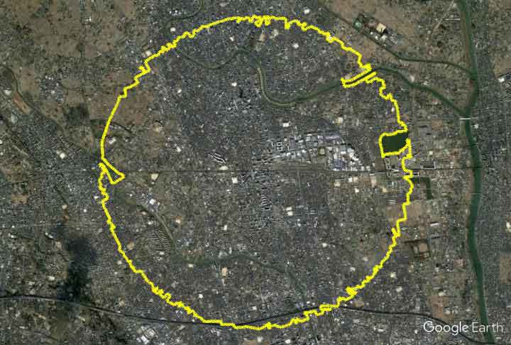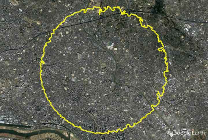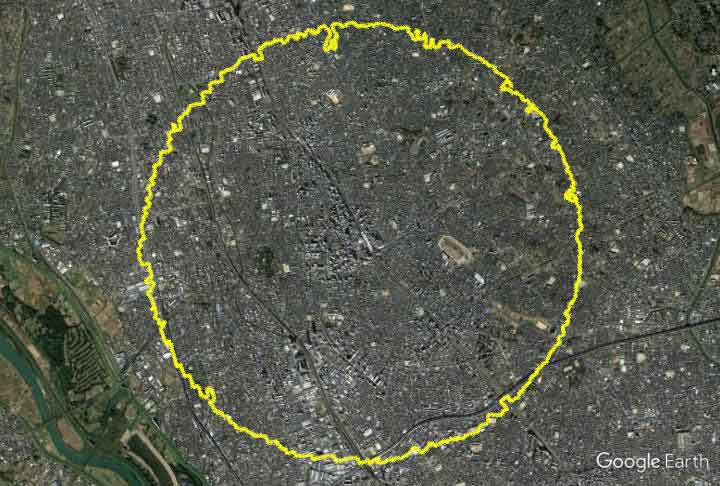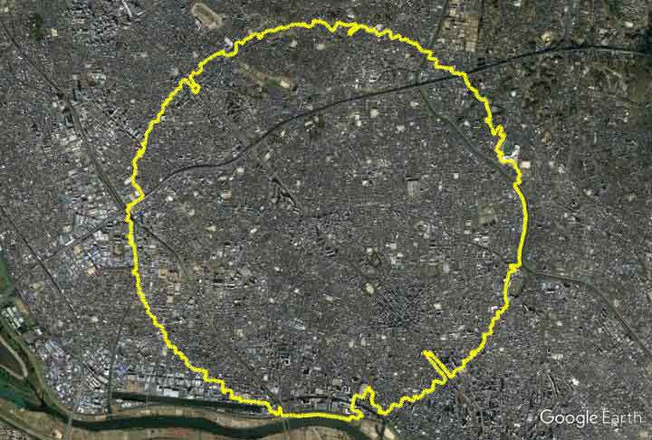
GPS Art as a Tool to Read Urban and Suburban Brackish Waters.
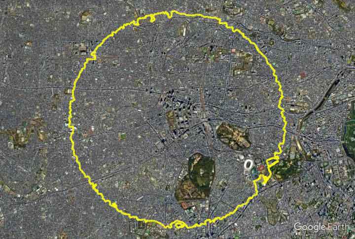
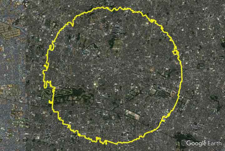
“Circle Walk” is a series of artworks that record the expression of the city through walking. The present state of the city, born as an extension of human activity, is captured by GPS logger.
The experience of using GPS to draw around the world as a canvas led me to think about urbanization and its processes, and I began to work on it as a theme.
All Circle Walks are regular circles with a radius of 3.1415 km centered on the center of the community. This distance is the brackish water area between the city center and the suburbs.
By keeping a common distance from the center, the expansion of each city and the nature of resistance are visualized. Along the way, residential areas, schools, golf courses, factories, warehouses, fields, and wooded areas …… coexist with human and natural activities, creating a unique expression.
The same city can also be a different circle depending on the day you walk through it. Roads grow daily, facilities open and close, and off-limits areas due to weather and construction …….
The interplay of those interferences and Yassan’s walking draws the most perfect circular path in the city that day.